
Home ... Prince Edward Island ... Maps
Prince Edward Island Photo Galleries - The Hillsborough River
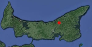
The Hillsborough River is the largest saltwater estuary on Prince Edward Island. At the Head of the Hillsborough, the water
is fresh and is home to a freshwater ecosystem. But as you paddle south the river changes to a saltwater tidal estuary and
the ecosystem significantly changes.
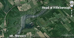
These photos were taken above Mt. Stewart. The river over the past 10 years has changed. A new bridge was constructed on
the Confederation Trail at Mt. Stewart. It replaced an old sleuce that ran under the trail but was slowly collapsing. I don't know
if it was to save money or just human error but the bridge re-directed the tidal current directly to the shore on both sides of
the bridge. This has created erosion and much siltation along this stretch of the river.
A couple of residences downstream of the new bridge had to dump large rocks along the shoreline to protect their properties from
washing away and upstream the marsh and corresponding bank is slowly disappearing.
 |
 |
© FletchWeb Productions